It’s amazing to see so many people becoming enthusiastic about the outdoors. However they also need to be enthusiastic about learning proper ethics and sticking to the correct skill level. Leaving GPS locations on photos, for beginners to find, is dangerously overcrowding popular trails and areas. With the Photo Investigator viewing, removing, or editing photo and video GPS locations are much easier than your last hike.

When someone on social media posts a beautiful place with an exact GPS location, it’s easy for others to exploit. For many, leaving no trace has been instilled since childhood. Sometimes with beginners to the outdoors, these principles aren’t common knowledge. If all the research someone does is looking at an Instagram photo, then the outdoors are in trouble.
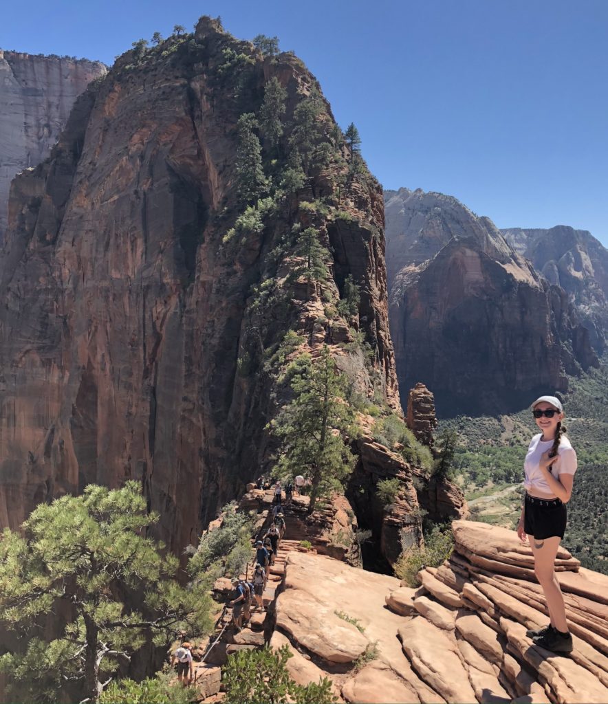
Angels Landing in Zion National Park is a great example of how editing or removing GPS locations from photos before posting them on social media can help. The view at the end of this hike is incredible, overlooking the entire green speckled, red rock canyon. Of course this is all we see from Instagram posts, but people go without researching the sketchy and strenuous hike. At parts, a chain has been installed to prevent people from falling to their death, one person crossing at a time. When I did the hike, I noticed many people trembling and making missteps, which is incredibly dangerous. Obviously, many people didn’t know what the hike entailed. Leave No Trace calls these places Hot Spots. Many climbers have flocked to Hot Spots, such as Red River Gorge in Kentucky. Leave No Trace has started programs to educate people about sustainable practices.
Use the Photo Investigator to review, remove or edit GPS metadata from photos and videos before sending them. This will help those inspired by your pictures to do proper research. Researching the trails in the area, the skill level of each activity, local fauna, and hopefully some leave no trace advice will help the environment. Which may inspire people to visit more than just the one picturesque hike. This keeps people at their skill level and aspiring for the next hike. Instead of going on something they are uncomfortable doing. The Photo Investigator enables viewing and removing the location of photos with a share extension, making it easy to leave no GPS trace. Editing photos and videos in bulk is also available, because we all know it’s not just one picture!
Of course we all want to post that sweet picture of a hike we accomplished, but we owe it to the earth to be honest and leave no trace. Stating the difficulty of the outdoor activity will keep people aspiring for better things at their level. Also, including leave no trace principles in your captions will encourage sustainable experiences the next time the readers are outdoors. Removing the GPS location from your adventure photos is much easier than cleaning up after a group that didn’t know plastic doesn’t degrade.
The Photo Investigator App makes viewing, editing, removing and sending photo metadata easy. Photo and video metadata may include location (if added by the camera), date, device, software versions, file size, file name, an “iOS Metadata” section, and many more metadata items. more. Users can view and share DEPTH MAPS by selecting a portrait photo and tapping “Portrait”.